The Karst Depressions of Los Haitises National Park: Dolines, Valleys and Natural Drainage
Los Haitises National Park is famous for its steep limestone hills, tropical forests, mangrove channels and natural caves. Yet another important feature of its landscape is found between the hills: a network of natural depressions that helps define the region's distinctive karst topography.
These depressions are not simply low areas between mountains. Many have developed through the gradual dissolution of limestone by water. Some form rounded or elongated hollows, while others are connected to create larger and more complex landscape features.
Geological surveys describe Los Haitises as an area of intense karst development, with large dolines and mogotes arranged in a characteristic tropical landscape often compared to an egg carton. Some mapped depressions have major axes exceeding 500 metres and depths reaching around 100 metres. These figures describe features identified in the geological mapping, not every depression in the park.
The depressions also influence how water moves. Rainfall may collect temporarily at the surface, flow toward lower ground or enter fractures and openings in the limestone. Some water eventually becomes part of the underground drainage system.
Understanding these features helps explain the connection between the park's hills, valleys, caves, groundwater and wetlands.
1. What Are Karst Depressions?
Karst depressions are low areas formed in landscapes underlain by soluble rocks, particularly limestone.
They develop through geological processes that remove or redistribute rock material. In many cases, water gradually dissolves limestone and creates hollows at the surface.
The term doline is commonly used for a closed depression in a karst landscape.
Karst depressions can differ in shape and size. Some are small and rounded, while others are broad, elongated or irregular.
In Los Haitises, geological mapping identifies an extensive field of large depressions associated with tropical karst topography.
These features occur alongside mogotes, creating a landscape of elevated limestone hills and lower enclosed areas.
2. Why Los Haitises Has So Many Depressions
The geology of Los Haitises provides favorable conditions for the development of karst landforms.
Much of the region is underlain by limestone belonging to the Los Haitises Formation. Limestone can be gradually dissolved by water, particularly when that water contains carbon dioxide absorbed from the atmosphere and soil.
Limestone dissolution
Rainwater absorbs carbon dioxide as it passes through the atmosphere and soil. This produces weakly acidic water.
When the water comes into contact with limestone, it can dissolve some calcium carbonate.
The process is slow, but it can continue over long periods and gradually enlarge small cracks and openings.
Natural weaknesses in the rock
Limestone contains fractures, joints and other structural weaknesses.
Water can move through these openings and dissolve the surrounding rock.
The distribution of these weaknesses can influence where depressions develop and how they are shaped.
Tropical weathering
Warm, humid environments with substantial rainfall can support active chemical weathering.
In the Los Haitises region, long-term karst processes have produced a landscape containing numerous depressions, mogotes and underground openings.
The combination of soluble rock, water movement and geological structure helps explain the density of karst features in the area.
3. Dolines: The Characteristic Depressions of Los Haitises
Dolines are among the most important surface features of the Los Haitises karst landscape.
They are closed or nearly closed depressions that commonly develop through limestone dissolution or the collapse of material above an underground cavity.
Dissolution dolines
A dissolution doline develops as water gradually dissolves limestone.
The process may begin along fractures or other openings. As dissolution continues, the surface can develop into a rounded or elongated hollow.
Collapse dolines
A collapse doline forms when material above an underground cavity loses support and falls into the opening.
Collapse features are one possible type of karst depression, but the origin of an individual depression cannot be established from its appearance alone.
Shape and dimensions
Dolines can have different outlines.
Some are rounded, while others are elliptical or irregular. Their size depends on geological structure, the development of underground openings and the history of dissolution.
The Dominican National Geological Service's geomorphological report for the Sánchez map sheet describes Los Haitises as an area of large dolines and mogotes. It notes that some mapped depressions have major axes exceeding 500 metres and depths reaching approximately 100 metres.
These measurements demonstrate the scale of the regional karst landscape.
4. The Cockpit Karst Landscape: Hills and Depressions Together
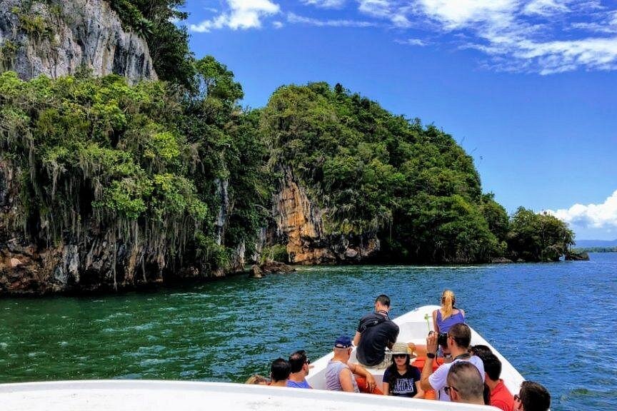
One of the most distinctive features of Los Haitises is its tropical cockpit karst landscape.
The term cockpit karst describes a terrain containing numerous enclosed depressions separated by residual hills.
The pattern can resemble an irregular arrangement of hills rising between hollows.
The relationship between mogotes and depressions
Mogotes are elevated limestone hills, while dolines are lower depressions.
They are different parts of the same broad karst landscape.
As dissolution affects limestone over long periods, the surface becomes increasingly irregular. Higher rock masses remain as elevated features, while lower areas develop into depressions.
Why the landscape looks like an egg carton
Geological descriptions compare the dense arrangement of hills and depressions in Los Haitises to an egg carton.
This comparison helps explain the landscape's repeated pattern of elevated and lower ground.
However, the individual hills and depressions are not identical. Their shapes are influenced by local geology, fractures, drainage and the history of weathering.
A distinctive regional landform
The National Geological Service identifies Los Haitises as a strongly karstified area with large, commonly elliptical depressions and mogotes.
The mapped orientation and distribution of these features also indicate that the underlying geological structure influences the development of the landscape.
5. How Water Enters a Karst Depression
Karst depressions can influence the movement of rainfall across the landscape.
In a closed depression, water may collect temporarily at the lowest point. Depending on the local geology, it may then infiltrate into the ground or leave through an outlet.
Rainfall reaching the depression
Rain falls on the surrounding hills, vegetation and exposed rock.
Some of this water enters the soil or limestone directly. Other water moves across the surface toward lower ground.
Surface runoff
Water flowing down a slope can enter a depression and collect there.
The amount of surface water depends on rainfall, vegetation, soil conditions and the shape of the surrounding terrain.
Infiltration
Water may enter the ground through soil, fractures and openings in limestone.
In some karst depressions, openings can act as natural absorption points, allowing surface water to enter the underground system.
Temporary water accumulation
Not every depression remains dry.
Depending on its geology and drainage characteristics, a depression may hold water temporarily or support wetter conditions.
The presence and duration of surface water vary between locations and seasons.
6. Sinkholes and Natural Absorption Points
Some karst depressions are associated with openings through which surface water enters the underground system.
These features are commonly called sinkholes or swallow holes, depending on their form and function.
They are important because they provide connections between surface water and groundwater.
How absorption openings develop
Water can gradually enlarge fractures and openings in limestone.
As these openings become more developed, they may provide pathways through which surface water can enter the subsurface.
Closed and open drainage features
The National Hydrogeological Study of the Los Haitises region describes different forms of water absorption in the karst system.
Some are closed depressions associated with fractures, while others are more directly connected to open drainage pathways.
The study identifies dolines as important absorption features in the region.
Why they matter
Absorption openings can transfer surface water into underground drainage routes.
This means that water entering a depression may travel through the limestone rather than continuing along a visible surface stream.
The exact route depends on the underground structure and requires geological or hydrogeological investigation to establish.
7. Valleys Between the Limestone Hills
The lower areas between mogotes contribute to the varied topography of Los Haitises.
Some are narrow valleys, while others form broader depressions or irregular low-lying spaces.
Their shape and drainage conditions depend on the surrounding limestone formations.
How valleys develop
Karst valleys can develop through several interacting processes, including dissolution, the merging of depressions and the modification of existing landforms.
Some low areas may also reflect the underlying geological structure.
It is therefore important not to assume that every valley in Los Haitises formed in exactly the same way.
Water movement through lower areas
Rainfall and runoff can move from elevated ground into valleys.
Some water may accumulate, while other water infiltrates through the soil and fractured limestone.
Vegetation in the valleys
Lower positions may provide different growing conditions from exposed hilltops.
Differences in soil depth, moisture and drainage can influence which vegetation becomes established.
These local variations contribute to the park's diverse landscape.
8. Uvalas and Larger Karst Depressions
In karst geology, an uvala is a larger irregular depression that can develop through the enlargement or joining of smaller depressions.
The term is useful when describing complex karst landscapes, but it should not be applied automatically to every low area in Los Haitises.
How uvalas develop
Several smaller dolines may expand toward one another.
Over time, the areas between them can become lowered or removed through dissolution, creating a larger and more irregular depression.
How they differ from dolines
A doline is generally a more individual depression.
An uvala is usually larger and more irregular, often reflecting the connection of several smaller karst forms.
Why terminology matters
Geological maps and field studies use specific criteria when identifying landforms.
A large valley or hollow is not necessarily an uvala. Its origin and shape must be assessed before assigning a geological name.
The wider Los Haitises region contains different types of karst depressions, but their distribution should be interpreted using geological mapping rather than visual assumptions alone.
9. The Connection Between Depressions and Underground Drainage
One of the most important characteristics of Los Haitises is that its surface and underground water systems are connected.
Karst depressions can serve as points where water moves from the land surface into the limestone.
Underground pathways
Water can travel through fractures, joints, cavities and larger underground passages.
The size and connectivity of these openings influence how quickly water moves.
Springs
Groundwater may eventually emerge at springs where underground pathways meet the land surface.
The location of a spring depends on the geological structure and the direction of groundwater movement.
Rivers and wetlands
Research on Los Haitises identifies connections between groundwater and wetland environments.
The 2013 study Humedales en Los Haitises, República Dominicana describes numerous wetlands in the karst region that are linked to groundwater.
This helps explain why surface water, underground drainage and wetlands should be considered together when studying the park's hydrology.
Why surface maps are not enough
A surface map shows hills, valleys and visible watercourses, but it cannot reveal every underground pathway.
Understanding the complete drainage system requires hydrogeological information, field observations and, where appropriate, tracer studies.
10. Do All Karst Depressions Contain Lakes or Wetlands?
No. A karst depression does not automatically contain a permanent lake or wetland.
Some depressions remain relatively dry, while others may collect water during rainfall or support wetter conditions.
Their water behavior depends on several factors:
- The permeability of the underlying limestone
- The presence of fractures and underground openings
- The shape and depth of the depression
- Soil thickness and surface material
- Rainfall and seasonal conditions
- The presence or absence of natural outlets
A depression with an effective underground drainage pathway may lose water relatively quickly.
Another depression may retain water for longer if its bottom contains less permeable material or if drainage is restricted.
The exact conditions need to be established for each location.
11. How Karst Depressions Support Different Habitats
The variations in elevation, drainage and moisture associated with karst depressions can influence local habitats.
Forested slopes
The slopes surrounding depressions can support vegetation adapted to the local limestone terrain.
Root systems, soil pockets and rock fractures help determine where plants can establish.
Lower valleys
Some lower positions may accumulate soil and organic material.
Where moisture remains available for longer periods, vegetation can differ from that found on exposed limestone hills.
Wetland environments
Certain wetland habitats in the Los Haitises region are connected to groundwater.
These environments are important for aquatic and semi-aquatic organisms as well as birds and other wildlife.
Habitat variation
The combination of elevated limestone hills, lower depressions, forested slopes and wetter areas creates a varied landscape.
The relationship between geology and water therefore contributes to the park's ecological diversity.
12. Why the Depressions Are Important for Conservation
Karst depressions are part of a connected geological and hydrological system.
Disturbance in one location can potentially affect water movement or environmental conditions elsewhere in the system.
This is particularly important where surface water enters underground openings.
Protecting natural drainage
Blocking, filling or redirecting natural drainage features can change the movement of water.
Any activity that alters a karst depression should be assessed carefully.
Preventing pollution
Water entering a sinkhole or other absorption opening may move into the underground system.
Waste disposal, chemical contamination and careless activities near these features can therefore create risks for groundwater quality.
Protecting vegetation
Native vegetation helps protect soil and contributes organic material to the ground.
Removing vegetation can alter surface conditions and increase the vulnerability of disturbed areas.
Avoiding damage to geological features
Dolines, sinkholes and other karst structures are natural geological features.
Filling, excavating or damaging them can permanently change their form and function.
Protecting these landforms helps preserve both the visible landscape and the hidden water system.
13. Responsible Ways to Explore the Karst Landscape
Visitors can appreciate the unusual landscape of Los Haitises without disturbing its natural features.
A few simple practices can help protect the area.
Follow authorized routes. Do not enter restricted areas or walk into depressions and openings without permission.
Never enter an unknown sinkhole. Some openings may contain unstable ground or hidden hazards.
Do not throw rubbish into depressions. Waste can enter the soil and water system.
Avoid disturbing vegetation. Plants and roots contribute to the stability and ecological function of the landscape.
Do not remove rocks or geological material. Natural formations should remain undisturbed.
Follow guide instructions. Local guides can explain which locations are appropriate and safe for visitors.
Responsible exploration allows visitors to enjoy the landscape while helping preserve its geological and ecological value.
Conclusion: The Hidden Drainage Landscape Between the Hills
The karst depressions of Los Haitises National Park are essential parts of its distinctive geological landscape.
Dolines, larger hollows, valleys and other depressions developed through the long-term interaction of limestone, water and geological structure. Together with the surrounding mogotes, they create the characteristic tropical cockpit karst scenery of the region.
These landforms also influence how rainfall moves across and beneath the surface. Some water collects temporarily in lower areas, while other water enters fractures and underground openings. This underground movement helps connect the karst landscape with springs, rivers and wetlands.
Protecting the depressions means protecting more than the park's scenery. It also means safeguarding natural drainage pathways and the ecological systems connected to them.
The next time visitors see the limestone hills of Los Haitises, they can also appreciate the remarkable network of natural hollows and hidden water routes that lies between them.
Frequently Asked Questions
1. What are karst depressions in Los Haitises?
Karst depressions are low areas formed in the limestone landscape through processes such as rock dissolution and, in some cases, collapse above underground cavities. Dolines are among the characteristic examples in Los Haitises.
2. What is a doline?
A doline is a closed or nearly closed depression in a karst landscape. It can form through the gradual dissolution of limestone or the collapse of material above an underground opening.
3. Why does Los Haitises have so many dolines?
The region has extensive limestone formations that have been affected by water and chemical dissolution over long periods. Fractures and other weaknesses in the rock help water move through the limestone and contribute to the development of depressions.
4. How large are the depressions in Los Haitises?
The Dominican National Geological Service's geomorphological mapping describes some depressions with major axes exceeding 500 metres and depths reaching approximately 100 metres. These are mapped regional examples, not measurements of every depression.
5. What is cockpit karst?
Cockpit karst is a tropical landscape characterized by numerous depressions separated by residual hills. Los Haitises is a well-developed example of this type of karst terrain.
6. Do all depressions in Los Haitises contain water?
No. Some may remain relatively dry, while others can collect water temporarily or support wetter conditions. Their water behavior depends on local drainage and geological characteristics.
7. What is the difference between a doline and an uvala?
A doline is generally an individual karst depression. An uvala is a larger, more irregular depression that may develop through the expansion or joining of several smaller depressions.
8. How do karst depressions connect to groundwater?
Water can enter the limestone through fractures, openings and absorption features within depressions. It may then travel through underground pathways before emerging at springs or contributing to other water environments.
9. Are the wetlands of Los Haitises connected to underground water?
Research published in 2013 describes numerous wetlands in the Los Haitises karst region that are linked to groundwater. The relationship varies by location and wetland type.
10. Can visitors explore sinkholes in Los Haitises?
Visitors should not enter unknown sinkholes or restricted depressions. Exploration should only take place in authorized areas with appropriate guidance and permission.

Local explorer & expert guide in Birding Dominican Republic.