Los Haitises National Park and Samaná Bay: How the Coastal Ecosystem Connects
Los Haitises National Park and Samaná Bay are closely connected parts of one of the Dominican Republic's most interesting coastal environments. The area brings together limestone formations, mangrove forests, river outlets, tidal waterways, coastal wetlands and marine habitats. These natural features do not function independently. Water, sediment, nutrients and wildlife move between them, creating a connected ecosystem that supports biodiversity and local livelihoods.
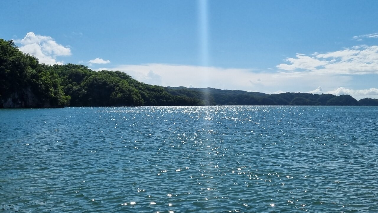
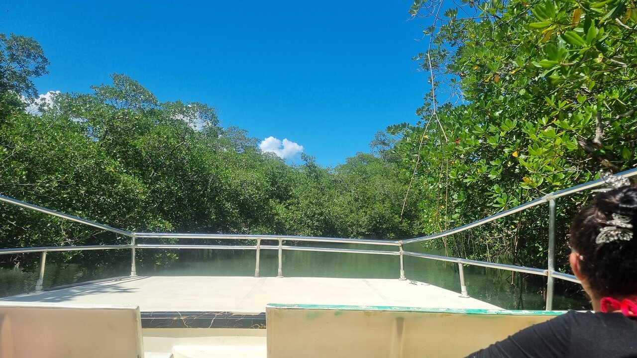
For travelers visiting Los Haitises from Sabana de la Mar, this connection is easy to appreciate. A boat journey may pass forest-covered limestone formations, narrow mangrove channels and sheltered coastal waters. Each landscape reveals a different part of the natural system.
Understanding how these environments work together makes a visit more meaningful. It also explains why protecting Los Haitises requires attention to the wider coastal environment of Samaná Bay.
1. Where Los Haitises Meets Samaná Bay
Los Haitises National Park lies along the southern side of Samaná Bay in northeastern Dominican Republic. Its protected landscape includes limestone hills, mangroves, coastal areas, caves and forest habitats.
Samaná Bay is a much larger coastal water body bordered by the Samaná Peninsula to the north, the eastern mountain region and Los Haitises to the south, and the Atlantic Ocean to the east. The western part connects with the lower Yuna River system.
This geography is important because the park is not an isolated natural area. Its coastal habitats form part of a wider bay system influenced by rivers, tides, rainfall, sediment movement and marine conditions.
The park's mangroves and coastal formations are among the visible links between land and sea. The surrounding bay provides the larger setting in which these habitats function.
2. The Role of Mangroves in the Coastal Ecosystem
Mangroves are among the most important habitats connecting Los Haitises with Samaná Bay.
These salt-tolerant trees and shrubs grow along sheltered tropical coastlines, tidal creeks and estuarine environments. Their roots help stabilize soft coastal sediments, while their branches and root systems create habitat for many organisms.
Four commonly identified mangrove species in the wider Samaná Bay wetland system are:
- Red mangrove (Rhizophora mangle): Recognized by its arching prop roots, which help support the tree in soft, waterlogged ground.
- White mangrove (Laguncularia racemosa): Often found in coastal and estuarine areas with suitable salinity and soil conditions.
- Black mangrove (Avicennia germinans): Known for specialized roots that can project above waterlogged sediment.
- Buttonwood (Conocarpus erectus): Often associated with the landward edges of mangrove communities.
Mangrove forests are not simply groups of trees beside the water. They are living coastal habitats that connect terrestrial, freshwater and marine environments.
3. How Rivers Connect the Inland Landscape to the Bay
Rivers are another major part of the Samaná Bay ecosystem.
Water flowing from inland areas carries freshwater, organic material and sediment toward the coast. When river water reaches the sea, it mixes with saltwater and helps create estuarine conditions.
The Yuna River is particularly important to the western part of Samaná Bay. Other rivers and streams, including the Yabón and La Yeguada, also contribute water and sediment to the broader bay system.
This movement affects the coastal environment in several ways.
Freshwater input: River flow changes the salinity of coastal water, creating conditions that support estuarine organisms and vegetation.
Sediment transport: Rivers carry natural particles from inland areas. These particles can settle in estuaries and coastal wetlands.
Nutrient movement: Organic material and nutrients move downstream and contribute to food webs, although excessive nutrient and sediment inputs can damage sensitive habitats.
Coastal change: Over time, river sediment and coastal processes can alter shorelines, mudflats and shallow-water areas.
These connections explain why activities far inland can eventually influence the condition of the bay.
4. Why Estuaries Are Important to Los Haitises and Samaná Bay
An estuary is an area where freshwater from rivers meets and mixes with saltwater from the sea. Salinity changes with tides, rainfall, river flow and seasonal conditions.
Estuaries are highly productive environments. Their sheltered waters and soft sediments provide habitat for fish, crustaceans, molluscs, birds and other organisms.
The wider Samaná Bay system includes important estuarine and wetland environments. Mangrove forests along these waters help connect the river system with coastal habitats.
For Los Haitises, these relationships matter because coastal wetlands and mangroves are influenced by conditions across the wider bay. Changes in water quality, sediment movement or freshwater flow can affect habitats even when the original disturbance occurs outside a particular mangrove channel.
5. How Mangroves Support Fish, Birds and Other Wildlife
Mangrove forests provide food, shelter and nursery habitat for many coastal organisms.
Their tangled roots create sheltered spaces where small fish and invertebrates can hide. Juvenile marine animals may use these habitats during important stages of their life cycles. Crabs, molluscs and other small organisms live among the roots and sediments.
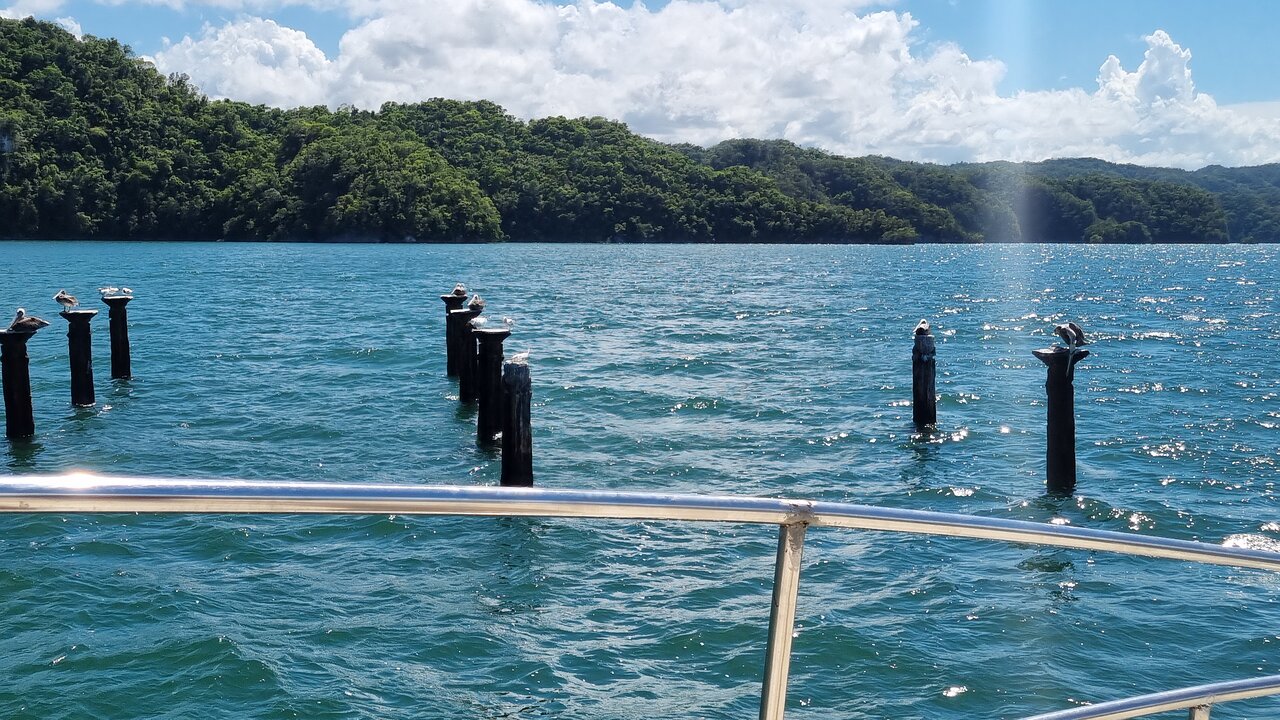
Mangroves also attract birds. Herons, egrets, pelicans and other coastal species may use the wetlands for feeding, resting or nesting, depending on the location and season.
The wider Los Haitises landscape supports a variety of birdlife, including species associated with forest and coastal habitats. The national park's mixture of mangroves, rainforest and limestone formations creates several different environments within one protected area.
The relationship is mutually important: healthy coastal vegetation supports wildlife, while the wider ecosystem depends on the continued functioning of its habitats.
6. How Tides Connect the Mangrove Channels to the Bay
Tides are a regular force shaping coastal ecosystems.
As the sea level rises and falls, tidal water moves through channels, creeks and low-lying mangrove areas. This movement influences water depth, salinity, sediment transport and the availability of feeding areas.
In mangrove forests, tidal exchange helps move organic material and nutrients between the forest floor and nearby waters.
For visitors travelling by boat through Los Haitises, the changing water level can influence the appearance and navigability of some waterways. Actual access depends on local conditions, the route and the vessel being used.
Tides are therefore more than a boating consideration. They are part of the natural process that keeps coastal habitats connected.
7. The Connection Between Limestone Coastlines and Mangrove Habitats
Los Haitises is well known for its limestone karst landscape. Its mogotes, caves and rocky coastal formations create a striking contrast with the softer mangrove environments.
These habitats can occur close together, but they develop under different physical conditions.
Limestone formations are shaped by geological processes, including the gradual dissolution of rock by water. Mangroves grow in coastal sediments where water movement, salinity and soil conditions allow them to establish.
Where these environments meet, the coastline becomes a varied landscape of rocky outcrops, sheltered waterways, forested hills and wetland vegetation.
This combination is one reason the park is so visually distinctive. It also creates a variety of habitats within a relatively compact coastal region.
8. Why Samaná Bay Is Important for Marine Wildlife
Samaná Bay is known for its marine wildlife, including the seasonal presence of humpback whales.
Humpback whales migrate through Caribbean waters and use the wider Samaná region during their winter breeding season. The bay is internationally recognized for its importance to humpback whale reproduction and related marine activities.
However, the whales' seasonal habitat should not be confused with the mangrove ecosystem. Mangroves are shallow coastal habitats, while whales use the wider marine waters of the bay and surrounding region.
These environments are part of the same coastal system, but each has its own ecological requirements.
Other marine organisms also depend on the bay's different habitats. The health of coastal waters, seagrass areas and other marine environments can influence the wider food web.
9. How Sediment and Water Quality Affect the Bay
Coastal ecosystems naturally receive sediment from rivers, rainfall, erosion and other processes. Some sediment is necessary for the formation and maintenance of wetlands and coastal landforms.
Problems can arise when sediment inputs become excessive or when pollutants enter rivers and coastal waters.
Research on Samaná Bay has examined changes in sedimentation and coastal conditions associated with river discharge, extreme weather and human activities in river basins. Such research highlights that the condition of the bay can be influenced by processes occurring far from the shoreline.
Potential pressures include:
- Removal of natural vegetation in river catchments.
- Poorly managed construction and land clearing.
- Agricultural runoff and soil erosion.
- Improper disposal of rubbish and wastewater.
- Coastal development that changes natural water movement.
- Excessive disturbance of sensitive wetland areas.
High sediment loads can increase water turbidity and affect habitats such as coral communities and other marine environments. Pollution can also harm organisms that depend on clean coastal water.
Protecting the bay therefore requires attention to both marine activities and land-based sources of environmental pressure.
10. Why the Ecosystem Matters to Communities Around the Bay
The coastal environment is important not only for wildlife but also for people living around Samaná Bay.
Fishing communities depend on coastal and marine resources. Mangroves, estuaries and other habitats contribute to the ecological conditions that support fish and invertebrate populations.
Tourism is another important part of the regional economy. Visitors come to experience Los Haitises, explore the bay, observe wildlife and discover the natural scenery around Sabana de la Mar and Samaná.
Healthy coastal ecosystems can support these activities by maintaining attractive landscapes and functioning habitats.
Responsible tourism should therefore respect the needs of local communities and the natural environment. Protecting the ecosystem is not separate from maintaining the long-term value of the destination.
11. What Visitors Can Observe on a Los Haitises Excursion
A visit to Los Haitises can offer an introduction to several connected coastal habitats.
Depending on the authorized route and current conditions, visitors may be able to observe:
Mangrove channels: Narrow waterways surrounded by coastal vegetation.
Limestone formations: Forest-covered hills and rocky outcrops along the coast.
Coastal birdlife: Birds feeding, flying or resting around mangroves and sheltered waters.
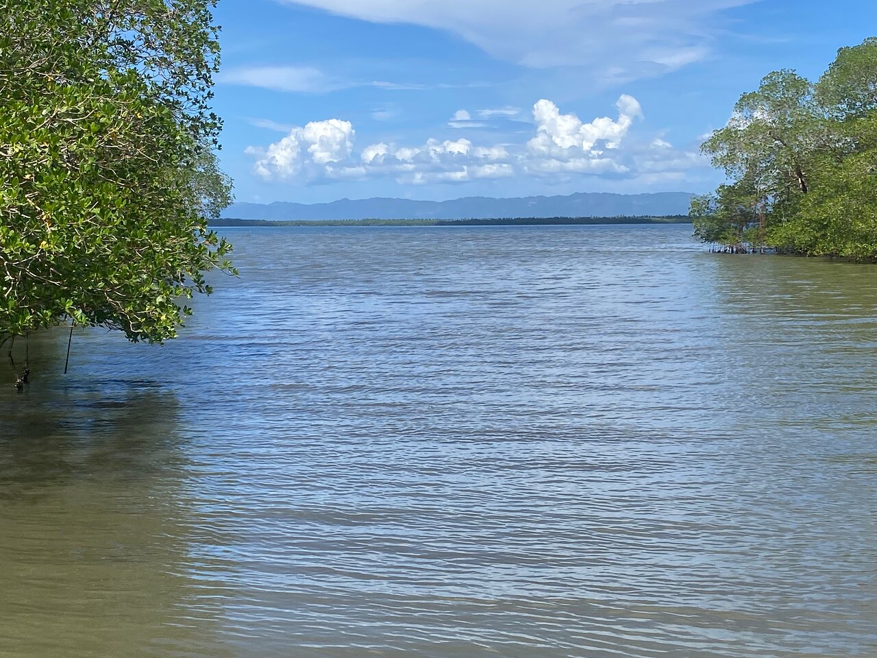
Estuarine scenery: Places where freshwater and seawater influence the coastal environment.
Open-water views: Wider perspectives of Samaná Bay and its surrounding landscape.
A boat trip can be particularly useful for seeing how the different habitats fit together. Visitors should remember that wildlife sightings are never guaranteed and that routes vary between excursions.
12. How to Help Protect Los Haitises and Samaná Bay
The health of a coastal ecosystem depends on many connected factors. Visitors can make a positive contribution by reducing their impact during a trip.
- Choose responsible excursions that respect protected-area rules.
- Avoid throwing rubbish into the water or leaving it on shore.
- Do not damage mangrove roots or remove vegetation.
- Keep a respectful distance from wildlife.
- Avoid loud or disruptive behavior near birds and other animals.
- Follow guide instructions and remain within authorized visitor areas.
- Support local businesses that respect environmental protection.
- Avoid purchasing wildlife products or collecting natural materials.
Conservation also requires wider action, including responsible land use, pollution control, sustainable fishing and protection of coastal wetlands.
13. Frequently Asked Questions
Is Los Haitises National Park part of Samaná Bay?
Los Haitises borders the southern side of Samaná Bay. The park's coastal habitats are connected to the wider bay ecosystem, but the entire bay is not part of the national park.
Why are mangroves important in Samaná Bay?
Mangroves provide habitat for coastal wildlife, stabilize soft sediments, help protect shorelines and connect land-based and marine food webs.
Which rivers influence Samaná Bay?
The Yuna is a major river influencing the western part of the bay. The Yabón and La Yeguada are among the other rivers contributing water and sediment to the broader coastal system.
Are the mangroves of Los Haitises connected to the sea?
Yes. Mangrove habitats are influenced by tidal water and coastal conditions. Their channels and surrounding wetlands form part of the wider coastal environment.
Can visitors see wildlife in Los Haitises?
Visitors may observe birds and other wildlife during an excursion, but sightings depend on natural conditions, season, weather and location. No wildlife encounter can be guaranteed.
Are humpback whales part of the Los Haitises mangrove ecosystem?
No. Humpback whales use the wider marine waters of the Samaná region during their seasonal migration and breeding period. They are part of the broader marine environment, not residents of shallow mangrove channels.
Why does water quality matter in Samaná Bay?
Water quality influences marine habitats, fish, invertebrates, coastal vegetation and the overall health of the ecosystem. Pollution and excessive sediment can damage sensitive environments.
Can I explore Los Haitises from Sabana de la Mar?
Sabana de la Mar is an access area for excursions into the eastern part of Los Haitises. Available routes and visitor stops depend on the operator, park rules and current conditions.
Experience the Connected Nature of Los Haitises and Samaná Bay
Los Haitises and Samaná Bay show how closely land, freshwater and marine environments are connected. Mangrove forests, river systems, estuaries, limestone coastlines and open waters all contribute to the region's natural character.
For visitors exploring the Dominican Republic, a trip from Sabana de la Mar offers an opportunity to experience more than beautiful scenery. It provides a closer look at a coastal ecosystem where every habitat plays a role.
Explore responsibly, respect protected areas and help preserve the natural environment that makes Los Haitises and Samaná Bay so special.
Local explorer & expert guide in Birding Dominican Republic.