The Underground Rivers of Los Haitises National Park: Hidden Waterways, Limestone Caves and Groundwater Movement
Introduction
Los Haitises National Park is widely recognized for its mangrove forests, limestone hills, coastal islands, wetlands and natural caves. Yet an important part of its landscape is hidden below the surface. Beneath the park's rugged limestone terrain, water moves through cracks, cavities and underground passages that are not visible from ordinary boat routes or forest trails.
These hidden waterways are part of the region's karst drainage system. Rainwater can enter the limestone through natural openings, travel underground and eventually emerge from springs or contribute to surface-water environments. In some places, water flows through cave passages as recognizable streams. In others, it moves through smaller fractures and interconnected openings.
Scientific investigations in the eastern part of Los Haitises have documented watercourses inside caves and used a fluorescent tracer test to investigate a connection between an explored cave and springs near the park's eastern boundary. This provides evidence that underground water movement is more than a theoretical feature of the landscape.
Understanding these hidden waterways helps explain the relationship between the park's caves, groundwater, springs, wetlands and surrounding ecosystems.
1. What Are Underground Rivers?
An underground river is a natural watercourse that flows below the Earth's surface. Unlike an ordinary river, which travels through an open channel, an underground river moves through caves, tunnels or other connected openings in rock.
Underground rivers are especially associated with karst landscapes. Karst develops where soluble rocks, particularly limestone, are gradually dissolved by water. Over long periods, this process can create fractures, cavities, passages and larger underground drainage routes.
Not every underground water passage is a river. Some contain a continuous stream, while others carry water only after rainfall. Groundwater may also move through narrow cracks that are too small to be recognized as cave channels.
For this reason, the term underground river should be used carefully. In Los Haitises, documented cave streams and groundwater pathways demonstrate underground water movement, but they do not establish that every cave contains a large flowing river.
2. Why Los Haitises Has Hidden Waterways
The geology of Los Haitises helps explain why underground drainage is important.
Much of the region is formed from limestone that has experienced extensive karst development. Rainwater absorbs carbon dioxide from the atmosphere and soil, becoming slightly acidic. As it moves over and through limestone, it can gradually dissolve the rock.
This process creates openings that may become larger over time.
Important features include:
- Fractures and joints: Natural breaks in limestone that allow water to enter and move through the rock.
- Cavities: Open spaces created by the gradual dissolution of limestone.
- Caves: Larger underground passages formed through long-term geological processes.
- Dolines: Closed depressions that can collect rainfall and help it enter the underground drainage system.
- Springs: Natural outlets where groundwater returns to the surface.
Together, these features allow rainfall and some surface water to become part of an underground drainage network.
The Dominican Republic's National Geological Service describes the Los Haitises hydrogeological unit as a strongly karstified limestone region. Its hydrogeological study explains how the development of karst features influences groundwater movement and discharge.
3. How Rainwater Enters the Underground System
The journey of underground water often begins with rainfall.
When rain reaches the forest and limestone landscape, some water runs across the ground toward streams, depressions and low-lying areas. Another portion infiltrates the soil or enters openings in the limestone.
The process can be understood in several stages.
Stage 1: Rain falls on the limestone landscape
Rainwater reaches forest-covered slopes, exposed rock, soil and natural depressions. The amount of water that enters the underground system depends on rainfall, soil conditions and the availability of openings.
Stage 2: Water enters fractures and depressions
Water passes through cracks, joints, dolines and other openings. Some depressions collect rainfall and direct it toward deeper parts of the karst system.
Stage 3: Water moves through underground passages
Below the surface, water follows connected openings. Small fractures may carry slow-moving groundwater, while larger passages can transport more concentrated flows.
Stage 4: Water reaches underground channels or storage zones
Depending on the shape and connectivity of the limestone openings, water may flow through cave streams, remain temporarily within the aquifer or move through smaller groundwater pathways.
Stage 5: Water emerges or continues underground
Groundwater can eventually reach a spring, enter a surface stream, contribute to a wetland or continue toward another discharge area.
This process shows why the visible surface landscape does not always reveal the complete route taken by water.
4. Cave Streams: Watercourses Inside Limestone Caves
A cave stream is a flowing body of water that travels through an underground cave passage. It may be permanent, seasonal or strongly influenced by rainfall.
In a limestone cave, water can move along the cave floor, collect in pools or pass through narrow channels. The shape and size of the passage influence how water travels.
Some cave streams may be easy to recognize because they flow through open passages. Others may be difficult to observe because the water disappears beneath sediment, enters narrow cracks or continues through inaccessible sections.
Speleological research carried out in the eastern part of Los Haitises in February 2010 included the exploration and mapping of caves. Researchers also collected water samples from cave streams and springs for hydrochemical and isotopic analysis.
This research provides direct evidence that watercourses occur inside caves in the park's karst landscape.
However, it is important not to assume that all explored caves contain streams or that every cave passage connects to the same underground route.
5. A Documented Underground Water Connection in Eastern Los Haitises
One of the most interesting findings from research in Los Haitises involved a fluorescent tracer test.
During the 2010 speleological investigation, researchers used a tracer called uranine to study the possible connection between an explored cave and springs near the eastern boundary of the park.
A tracer test is a scientific method used to investigate underground water movement. A detectable substance is introduced at a known point, and researchers monitor selected locations to determine whether it appears elsewhere.
The appearance of the tracer at a monitored spring can provide evidence that water travels between the tested locations through an underground pathway.
In the Los Haitises investigation, the uranine test helped establish a relationship between one explored cave and springs along the eastern boundary.
This is significant because underground connections are difficult to identify by observing the surface alone. A cave entrance and a spring may appear geographically separate, but the tracer test can provide evidence of a subsurface connection.
The result should be understood within its scientific scope: it investigated a particular cave-to-spring relationship. It does not prove that every cave in Los Haitises connects to those springs or that the entire park is served by one continuous underground river.
6. Underground Rivers and Groundwater Conduits: What Is the Difference?
The terms underground river, cave stream and groundwater conduit are related, but they do not describe exactly the same feature.
Underground river
An underground river is a substantial flowing watercourse beneath the surface. It usually follows a recognizable channel or cave passage.
Cave stream
A cave stream is water flowing through a cave. It may be small or large and can be permanent or temporary.
Groundwater conduit
A groundwater conduit is an underground opening that transports water through a karst aquifer. It may be a large cave passage or a smaller connected channel.
Groundwater fracture
A groundwater fracture is a crack or break in rock through which water can move. It may carry water without forming a visible cave stream.
Spring
A spring is a natural point where groundwater emerges at the surface.
These distinctions matter when describing Los Haitises. A cave containing a stream is not automatically a large underground river, and a groundwater connection does not necessarily mean that a person could follow it through a continuous cave passage.
7. How Underground Water Reaches Natural Springs
Groundwater eventually leaves parts of the underground system through natural discharge points.
A spring forms when groundwater reaches the surface. In a karst region, this may happen where an underground passage intersects a hillside, valley, stream channel or geological boundary.
The location of a spring depends on the structure of the rock, the shape of the underground drainage routes and the level at which groundwater can escape.
The eastern Los Haitises tracer investigation is particularly useful because it examined a relationship between a cave and springs near the park boundary.
Springs are important components of the wider water system. They can supply water to surface channels and help maintain wet environments, depending on their location and flow conditions.
The existence of a spring does not necessarily mean that it is accessible to visitors. Some groundwater outlets are located in areas that are difficult to reach or are not designated for public access.
8. The Relationship Between Underground Water and Wetlands
The underground water system is connected to the wetland environments of Los Haitises.
Research on the wetlands of Los Haitises describes numerous wetlands in a karst setting that are linked to groundwater. The researchers used water-level measurements, chemical sampling and isotopic analysis to investigate relationships among rivers, springs, wells and wetland environments.
This is important because wetlands are influenced by more than visible rainfall and surface streams. Groundwater can contribute to their water supply and influence water levels.
The relationship can work in different ways:
- Groundwater may discharge into a wetland.
- Springs may feed nearby surface-water channels.
- Rainfall may enter the limestone and later return to the surface.
- Wetland water may interact with shallow groundwater, depending on local geology and water levels.
The exact relationship varies from one location to another. Not every wetland receives the same amount of groundwater, and the contribution can change with seasonal conditions.
Protecting the underground drainage system is therefore relevant to the conservation of the park's wetlands and associated habitats.
9. Why Underground Water Movement Is Difficult to Observe
Unlike surface rivers, underground waterways are hidden by rock and soil. Their routes cannot usually be understood by looking at the landscape from above.
Several factors make underground drainage difficult to study.
Hidden passages: Water may travel through caves and openings that are not visible from the surface.
Complex routes: Karst drainage can follow interconnected fractures and conduits rather than a simple, straight channel.
Changing water levels: Rainfall can change the amount of water entering the system and the flow observed in caves and springs.
Limited access: Some cave passages are narrow, flooded or difficult to enter safely.
Uncertain connections: Two nearby water features are not necessarily connected underground. Scientific measurements or tracer tests may be needed to establish a relationship.
For these reasons, researchers use cave surveys, water sampling, hydrochemical analysis, isotope analysis and tracer testing to understand the underground environment.
10. How Scientists Study Underground Rivers in Los Haitises
Scientific research in a karst landscape uses several methods to understand water movement.
Cave exploration and mapping
Speleologists explore accessible caves and record their dimensions, passages and geological features. Mapping helps researchers understand the shape of underground spaces.
Water sampling
Researchers collect water from cave streams, springs and other selected locations. Samples can be analyzed for chemical characteristics that help explain the origin and movement of water.
Hydrochemical analysis
Hydrochemical analysis examines the dissolved substances and physical characteristics of water. Differences and similarities between samples can provide clues about water sources and underground pathways.
Isotope analysis
Water contains naturally occurring isotopes that can help researchers investigate its origin and movement. Comparing isotope characteristics from different water sources can provide evidence of hydrological relationships.
Tracer testing
A tracer test introduces a detectable substance at one location and monitors selected points for its appearance. The uranine test conducted during the 2010 eastern Los Haitises expedition is an example of this method.
Together, these techniques provide a more reliable understanding of underground water movement than surface observation alone.
11. Why Underground Waterways Matter for Conservation
Underground waterways are important because they connect different parts of the natural environment.
Water that enters limestone may later emerge at a spring or contribute to a wetland. Changes in the quality or quantity of water entering the karst system can therefore affect more than the location where pollution or disturbance occurs.
Conservation considerations include:
Protecting water quality: Pollutants entering fractures, sinkholes or other openings may reach groundwater pathways.
Preventing careless waste disposal: Waste should never be discarded in caves, depressions, streams or other natural openings.
Protecting vegetation and soil: Forest cover and healthy soils influence how rainfall reaches the ground and interacts with the karst landscape.
Respecting cave environments: Visitors should avoid damaging cave formations, disturbing wildlife or entering restricted passages.
Maintaining wetland connections: Groundwater, springs and wetlands form part of a connected ecological system that requires careful management.
The underground water system is not separate from the park's visible natural attractions. It is part of the ecological foundation that supports the wider landscape.
12. Can Visitors See Underground Rivers on a Los Haitises Tour?
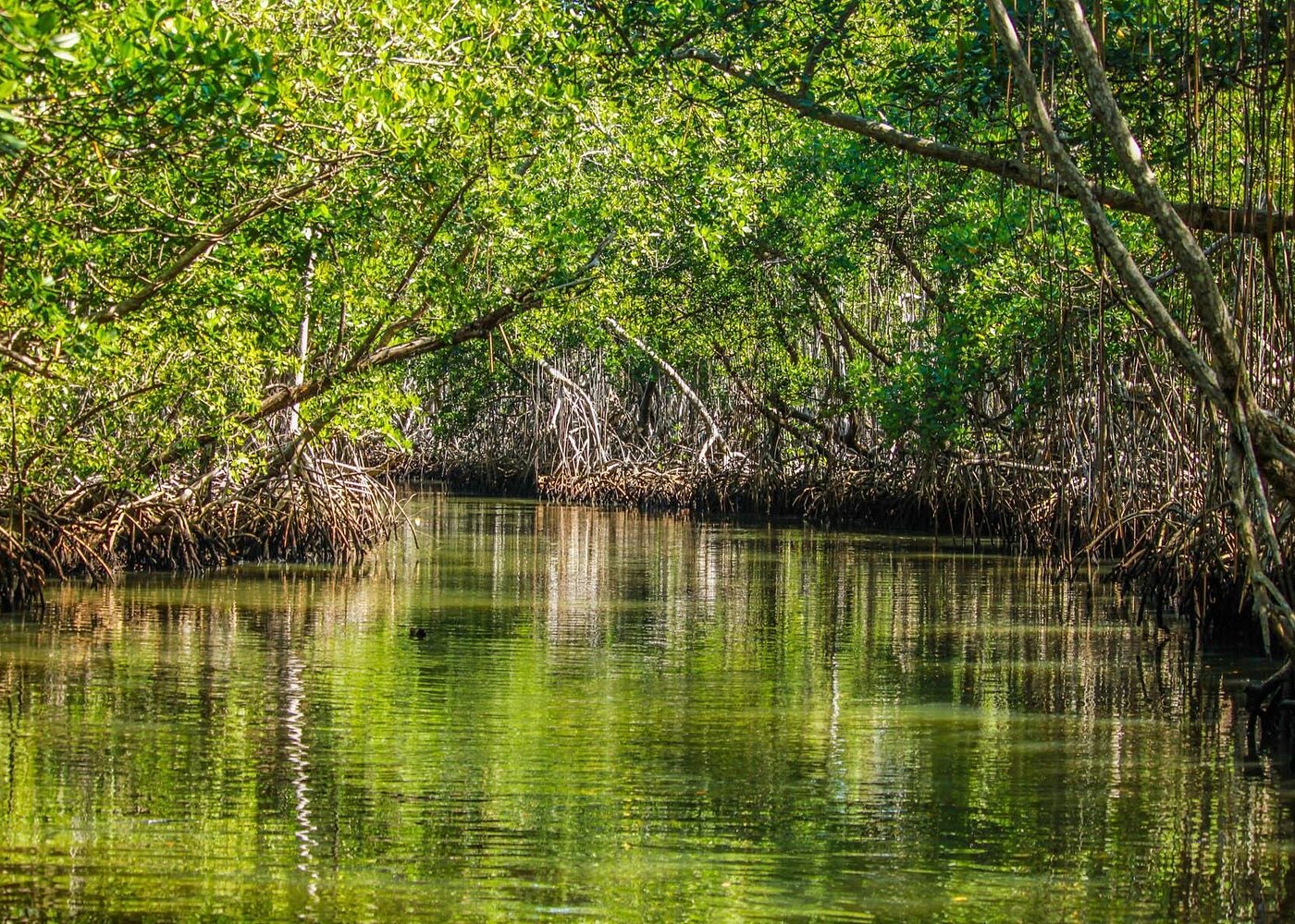
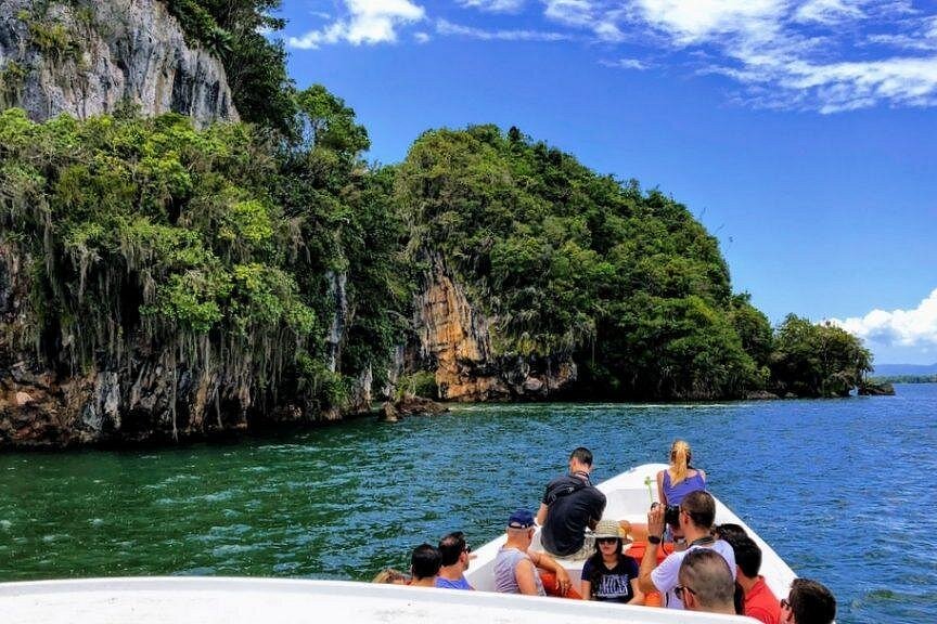
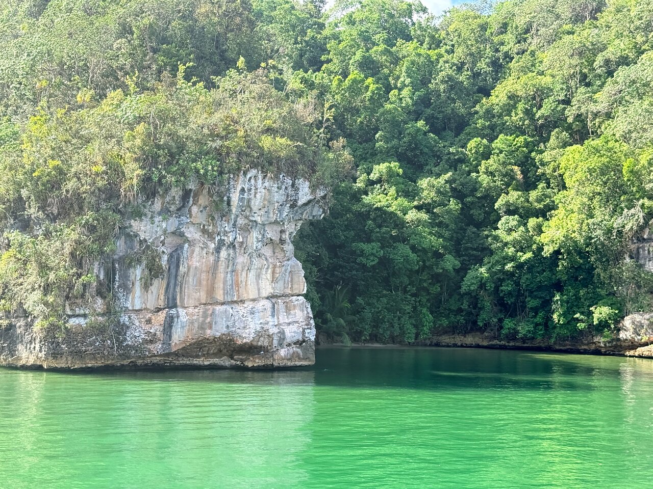
Visitors may see caves, limestone formations, mangrove channels and coastal scenery during an authorized Los Haitises excursion. However, this does not mean that a standard boat tour includes access to underground rivers.
Many underground watercourses are part of scientific or difficult-to-access cave environments. Some caves may contain water, but their accessibility and suitability for visitors depend on official management rules and current conditions.
Before planning a cave visit, travelers should confirm:
- Whether the cave is currently open to visitors.
- Whether access is included in the selected excursion.
- Whether a licensed or authorized guide is required.
- Whether the route involves walking, climbing, water or other physical challenges.
- Whether temporary closures or safety restrictions apply.
Do not enter an unapproved cave passage or attempt to follow underground water independently. Flooding, slippery rock, unstable surfaces and restricted spaces can create serious hazards.
A boat excursion through the park can still provide an excellent introduction to its visible karst landscape and coastal ecosystems without entering underground passages.
13. Responsible Ways to Appreciate the Hidden Water System
Even if visitors never see an underground river, they can help protect the natural processes that sustain it.
Follow designated routes and guide instructions. Avoid throwing rubbish into the water or leaving waste near cave entrances. Do not pour liquids or chemicals into natural openings. Never remove rocks, cave deposits, plants or other natural materials.
Visitors should also avoid disturbing wildlife around cave entrances and wetland edges. These environments are part of a larger ecological system, and careless activity can affect sensitive habitats.
The best way to appreciate the underground waterways of Los Haitises is to understand that the visible landscape is only one part of a much larger natural system.
Conclusion
The underground waterways of Los Haitises National Park reveal another dimension of its limestone landscape. Rainwater enters fractures, depressions and other openings, moves through underground passages and can eventually emerge through natural springs or contribute to wetland environments.
Scientific research in the eastern part of the park documented cave streams and used an uranine tracer test to investigate a connection between an explored cave and springs near the eastern boundary. This provides valuable evidence of underground water movement in the region.
Although the term underground river is useful for describing substantial subterranean watercourses, not every cave contains a river. Smaller cave streams, groundwater conduits and fractures also play important roles in the karst drainage system.
Understanding these hidden waterways helps explain why the conservation of caves, limestone terrain, groundwater and wetlands must be considered together. Beneath the remarkable scenery of Los Haitises, water continues to shape the landscape in ways that visitors may never directly see.
Frequently Asked Questions
1. Are there underground rivers in Los Haitises National Park?
Scientific research has documented watercourses inside caves and investigated underground water connections in the park. These findings demonstrate subsurface water movement, although they do not establish that every cave contains a large underground river.
2. What is a cave stream?
A cave stream is flowing water that travels through an underground cave passage. It may be permanent, seasonal or influenced by rainfall.
3. How does water enter the underground system?
Rainwater can enter through fractures, joints, dolines, cavities and other openings in limestone. Some surface watercourses may also lose water into karst openings.
4. What did the uranine tracer test in Los Haitises investigate?
A 2010 scientific expedition used uranine to investigate the relationship between an explored cave and springs near the eastern boundary of the park.
5. What is uranine?
Uranine is a fluorescent tracer used in hydrological investigations. Researchers can monitor its appearance at selected locations to study underground water connections.
6. Are underground rivers the same as groundwater?
Not exactly. Groundwater is water stored or moving beneath the surface. An underground river is a more clearly defined flowing watercourse within an underground passage or channel.
7. Do underground waterways supply the wetlands of Los Haitises?
Groundwater is connected to numerous wetlands in the karst region. Research has investigated the relationships among groundwater, springs, rivers and wetlands, although the contribution varies by location.
8. Can tourists swim in underground rivers in Los Haitises?
Visitors should not assume that underground water passages are open or suitable for swimming. Access depends on official permissions, safety conditions and the specific tour or activity.
9. Can visitors explore every cave in Los Haitises?
No. Some caves may be inaccessible, restricted or unsuitable for visitors. Travelers should follow official rules and use authorized guides.
10. Why should underground water systems be protected?
Underground water connects caves, springs, wetlands and surface-water environments. Protecting groundwater quality and natural drainage helps conserve the wider ecosystem.
Local explorer & expert guide in Birding Dominican Republic.